Mont Saint-Michel and its reflection in the waterMont Saint-Michel and its reflection in the water
©Mont Saint-Michel and its reflection in the water|Pauline Vidinic
The Wonder of the WestMont-Saint-MichelAnd its bay

Mont-Saint-Michel and its bay

A breathtaking natural setting and outstanding architecture

In a vast sandy plain, the scene of Europe’s highest tides, rises a rocky granite islet measuring around 960 meters in circumference and 92 meters in altitude. This islet is Mont Saint-Michel. On this rock stands a monumental abbey of prodigious architecture, the first stones of which were laid over 1,000 years ago! This building is Mont-Saint-Michel.

A little history

Du Mont Tombe

At Mont Saint-Michel

Before it became Mont Saint-Michel, the famous granite rock was called Mont Tombe, probably because it was shaped like a Roman tumulus or tomb. Historical sources indicate that the first buildings on the islet date back to the 6th century. Construction of the Mont began in 708. According to legend, during the reign of King Childebert III (695-711), thearchangel Michael appeared in a dream to Aubert, bishop of Avranches, ordering him to build a sanctuary in his honor. But it took three apparitions of the Archangel Michael to convince Saint Aubert. At the third apparition, Michel did not hesitate to leave his finger mark on Aubert’s forehead, even perforating his skull, as can be seen in the Basilica of Saint-Gervais in Avranches, where it is displayed. Aubert realized that this was no dream! He had a divine mission to accomplish: to build an oratory in honor of Saint-Michel. From then on, the rock became known as Mont-Saint-Michel-au-péril-de-la-Mer. Despite the islet’s location, the shifting sands and threatening tides that surround it, pilgrims soon flock to this new spiritual site, where a dozen canons officiate. The surrounding population also sought refuge from Viking raids. A village grew up on the rock and the church expanded. From 966 onwards, Richard I of Normandy (943-996) established a permanent community of Benedictine monks – who remained on the Mont until 2001. The abbey church was built on the rock’s summit in 1023. Over the centuries, the abbey, on the borders of the Duchy of Normandy, had to fortify itself. During the Hundred Years’ War, the royal army even moved in to prevent an English invasion. At the same time, the abbey expanded, and its famous ” marvel ” (the Gothic monastic living quarters) was built in the first half of the 13th century. The construction of the abbey, which continued from the 11th to the 16th century, was a technical and artistic tour de force, adapting to a very difficult natural site. Abandoned for a time – and even partly transformed into a state prison – the monument was restored at the end of the 19th century.t was restored at the end of the 19th century, with the addition of a spire raising the summit to 157.10 metres. Sources: Géo, Le Monde, Le Journal du Dimanche, Culturez-vous

Mont-Saint-Michel and its bay

A UNESCO World Heritage Site

In 1979, Mont-Saint-Michel and its bay were inscribed on UNESCO’s World Heritage List, making it one of the first French cultural assets to appear on the list. Some twenty years later, the site was once again listed, this time as part of the ” Chemins de Saint-Jacques-de-Compostelle en France ” serial site. This double recognition illustrates the universal and exceptional value of the site.

The Bay of Mont-Saint-Michel

Europe's biggest tides

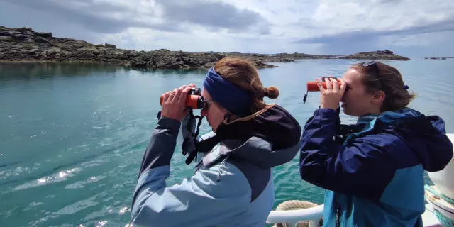
Covering an area of around 500 km², the Bay of Mont-Saint-Michel stretches between Cancale to the west (Brittany) and Granville to the north. The Bay of Mont-Saint-Michel has the highest tidal range in Europe, with an average amplitude of 10 meters, reaching 12 meters on average spring tides, and 15 meters during exceptional spring tides. These coefficients are accentuated by the shallowness of the bay and the barrier effect of the Cotentin peninsula. The region’s very high tidal range means that a large part of the bay is uncovered at low tide: up to 250 km² offoreshore, beaches andgrasslands. This immense space is spectacular! The sea disappears on the horizon, giving way to a sandy desert in the midst of which stands an impregnable sanctuary: Mont-Saint-Michel. This spectacle can be seen from a number of vantage points between Brittany and Normandy. Locals are particularly fond of watching the“mascaret“, the sea wave that runs up the estuaries. It’s the result of the shockwave between the sea and the rivers. The tides stir up the water, promoting biological production. With the rhythm of Europe’s highest tides, a very special flora and fauna evolves from hour to hour and season to season. The area is home to a wide variety of birds and sealife.

Bay crossings

A unique experience

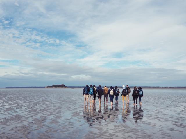
Would you like to cross the Bay of Mont-Saint-Michel on foot with a guide? Here’s a list of guides you can contact right away! Our guides are men and women with a passion for nature. And they’re happy to pass this love on to the many “pilgrims” on the trail. Along the 7 km crossing (14 km including the return), they’ll tell you the stories of yesteryear, the legends surrounding Mont-Saint-Michel and the Tombelaine rock, and provide you with valuable information on the geology, fauna and flora of this unique landscape.


Discover all the wonders of

Destination Granville Terre et Mer

In the bay of Mont-Saint-Michel
Mark, finger and eye fishing during high tidesMark, finger and eye fishing during high tides
©Mark, finger and eye fishing during high tides|Pauline Vidinic
Emmanuelle Marie Bateau Petite LauraEmmanuelle Marie Bateau Petite Laura
©Emmanuelle Marie Bateau Petite Laura|Estelle Cohier
The Chausey archipelago from the airThe Chausey archipelago from the air
©The Chausey archipelago from the air|Marie-Claude Vergne
Spectacle Des Marees Sur La Plage De Jullouville Credit Otgtm Pauline Vidinic 36675 1920pxTidal show on Jullouville beach
©Tidal show on Jullouville beach|Pauline Vidinic
The Abbey of La Lucerne d'Outremer and its pond in the foregroundThe Abbey of La Lucerne d'Outremer and its pond in the foreground
©The Abbey of La Lucerne d'Outremer and its pond in the foreground|Estelle Cohier
Toute La Mer Sur Un Plateau Le Festival Des Coquillages Et Des Crustaces Credit Otgtm Estelle Cohier 14338 4Toute La Mer Sur Un Plateau Le Festival Des Coquillages Et Des Crustaces Credit Otgtm Estelle Cohier 14338 4
©Toute La Mer Sur Un Plateau Le Festival Des Coquillages Et Des Crustaces Credit Otgtm Estelle Cohier 14338 4|Estelle Cohier
The Chausey archipelago from the airThe Chausey archipelago from the air
©The Chausey archipelago from the air|Julie Hurricane
Crossing the Bay of Mont Saint-Michel on foot with a certified guideCrossing the Bay of Mont Saint-Michel on foot with a certified guide
©Crossing the Bay of Mont Saint-Michel on foot with a certified guide|Cécile Ballon
A bird's eye view of Le Bout du Monde and the havre de la VanléeA bird's eye view of Le Bout du Monde and the havre de la Vanlée
©A bird's eye view of Le Bout du Monde and the havre de la Vanlée|Office de Tourisme Granville Terre et Mer
View of Tombelaine and Mont Saint-Michel from the Champeaux and Carolles cliffsView of Tombelaine and Mont Saint-Michel from the Champeaux and Carolles cliffs
©View of Tombelaine and Mont Saint-Michel from the Champeaux and Carolles cliffs|Estelle Cohier
Water lilies in the Bouillon pond in JullouvilleWater lilies in the Bouillon pond in Jullouville
©Water lilies in the Bouillon pond in Jullouville|Estelle Cohier
Close